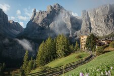
The mountain tour to the striking Sassongher - one of the most impressive panoramic peaks of the Alta Badia - starts in Colfosco
Image gallery: Mountain tour to Mt. Sassongher
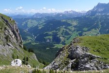
Starting point for this highly recommendable mountain tour is the parking space at the Colfosco high-rope course (or deer reserve). From this place we walk up towards the centre of the village, where the "Utia Edelweiss/Edelweisshütte" is indicated on the right hand-side. We follow the forested path no. 4 and soon reach the mountain hut, where we already decide to stop on our way back. The path becomes narrow and transforms into a mountain trail, we approach the rock faces of the Dolomites.
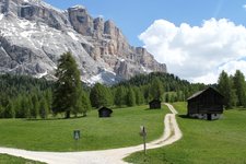
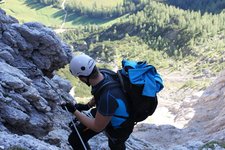
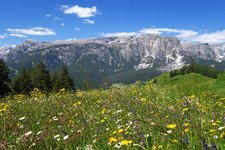
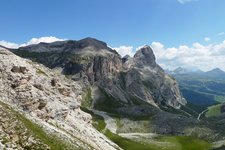
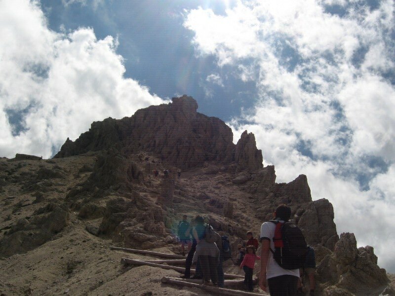
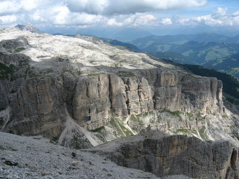
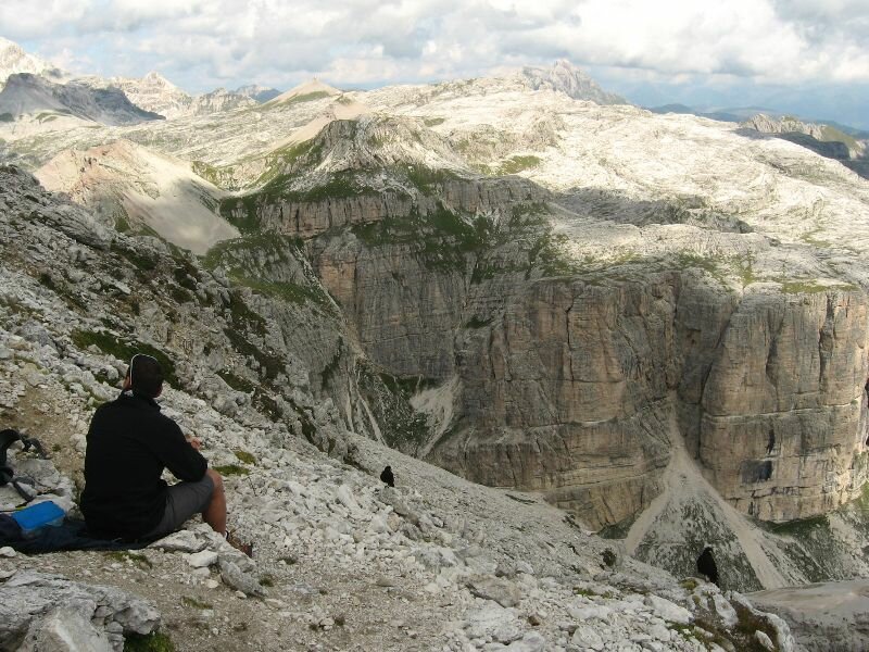
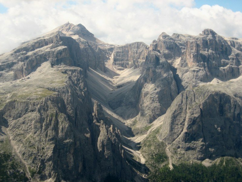
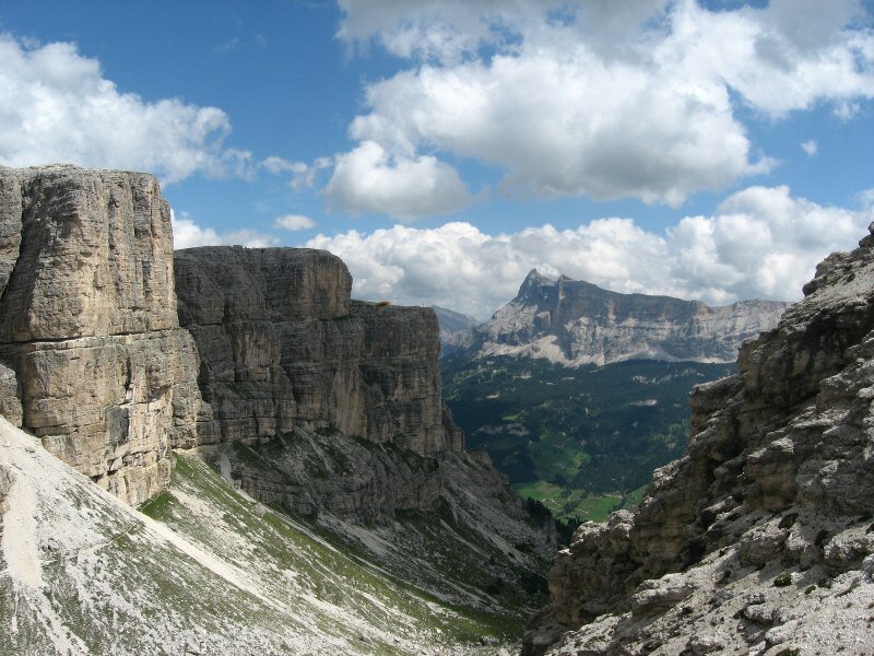
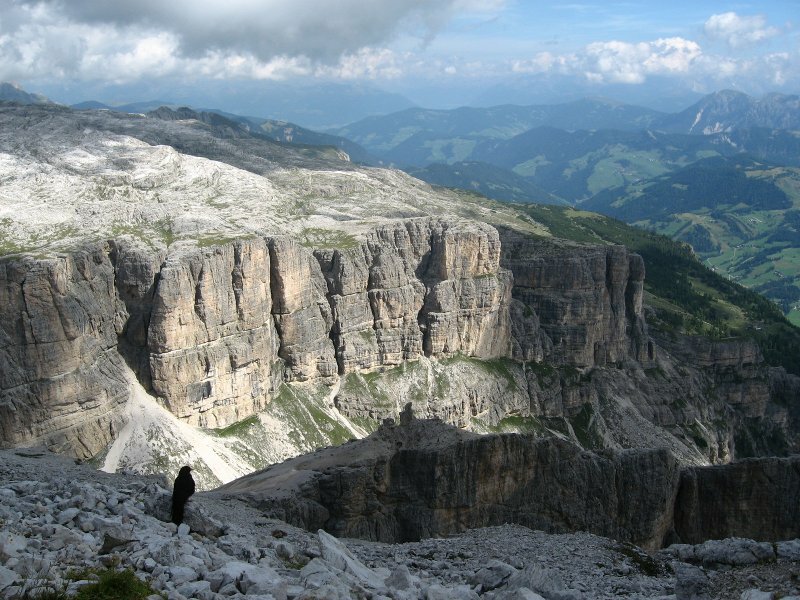
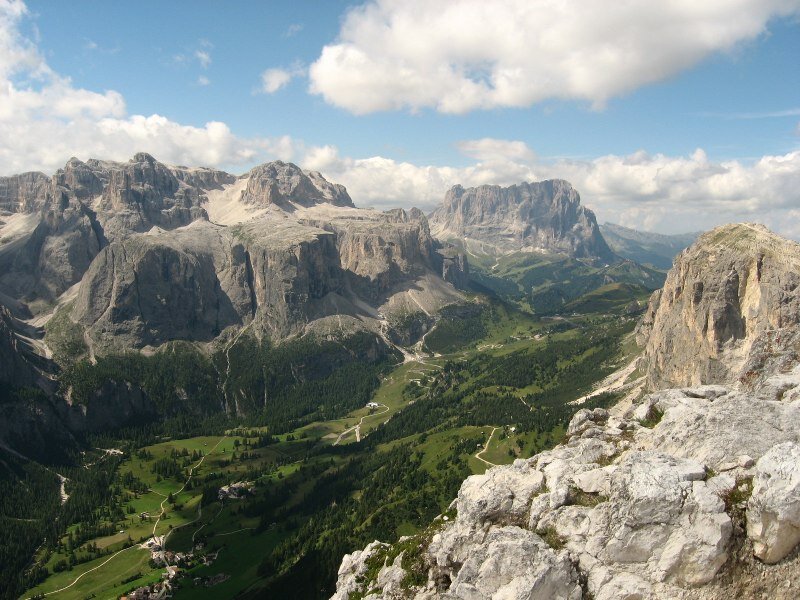
At 2,100 m a.s.l. the path to Mt. Sassongher branches off on the right. On this path we traverse underneath a rock face. On the opposite, there is the Sella Group with the Val Mezdí valley, known among freeriders. Be careful and watch out for your steps! At 2,435 m a.s.l. we reach the Forcella del Sassongher ridge, where an easy fixed-rope route starts, including also a section with huge steps. Experienced mountaineers don't need any securing devices, for others it is absolutely advisable. Here you also need your hands. In high season (especially August) there might also be jams in this place.
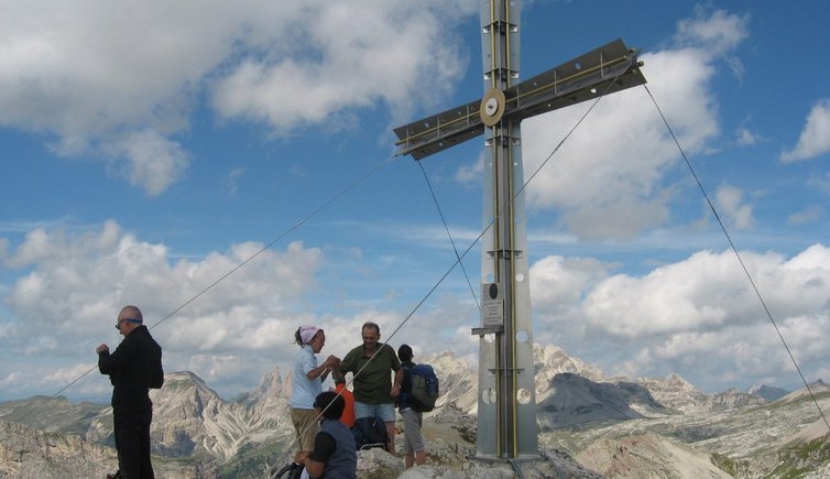
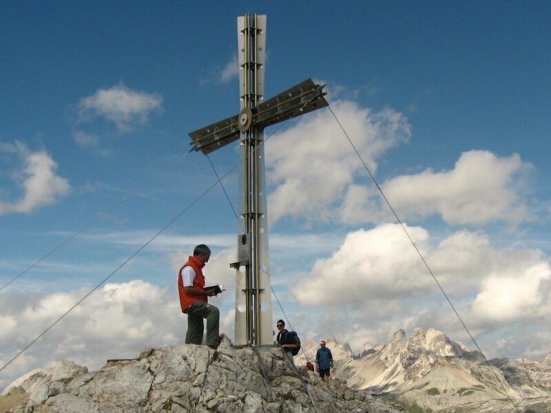
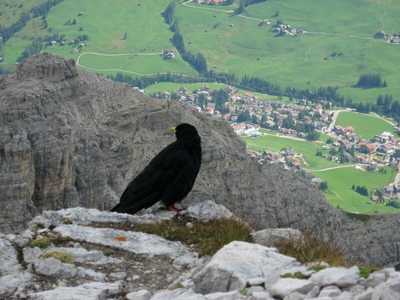
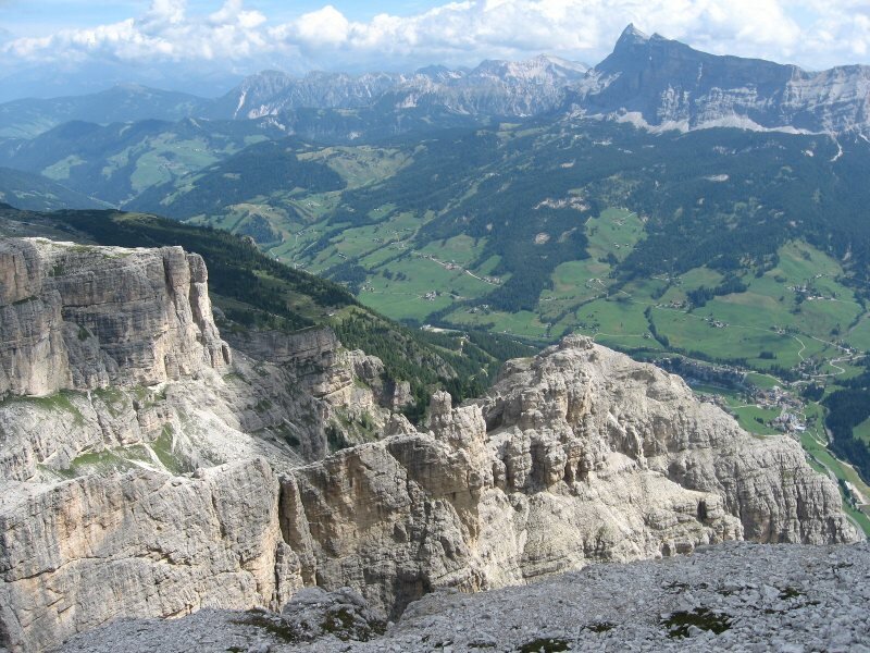
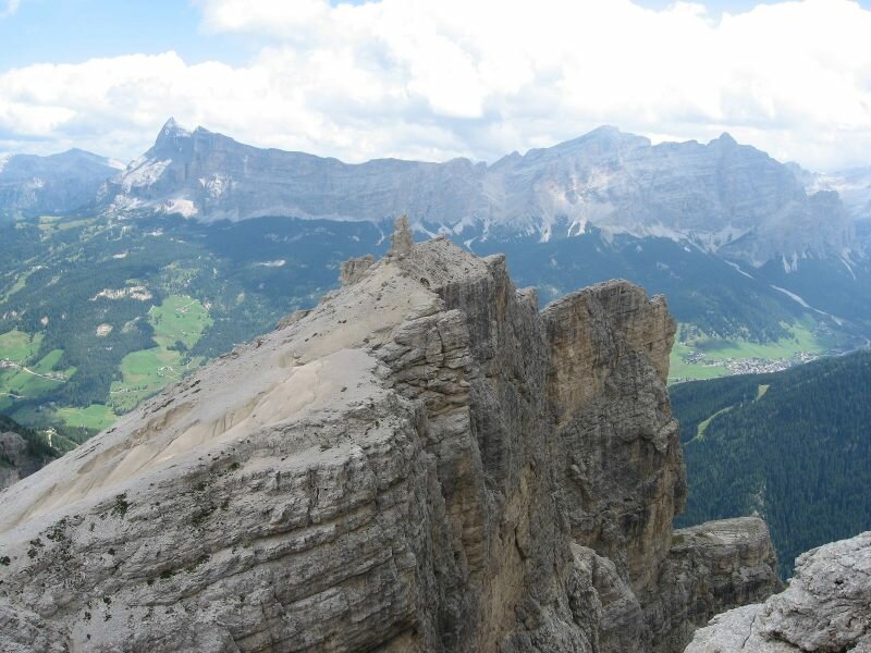
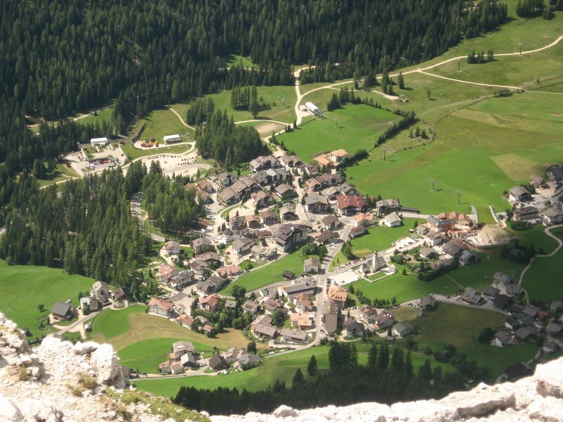
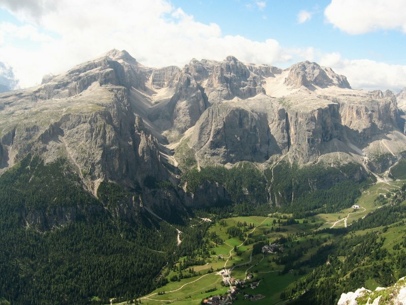
Afterwards we climb the last part in serpentines in eastern direction towards the 2,665 m high peak of the Sassongher, that provides an amazing view of the Val Badia valley, the Sella Group and Mt. Sasso di Santa Croce. Also Colfosco can be admired at our foot. For the way back down, we walk along the route on which we came. You absolutely should be free from vertigo for this tour. We recommend you to take walking poles for the descent, and of course a stop at the Ütia Edelweiss mountain hut, providing a great view on the Sella alpenstock.
Please note:Absolutely rewarding mountain tour for experienced, sure-footed hikers with good stamina and free from vertigo (difficulty: medium). This tour is a classical hike in Alta Badia (and therefore better to avoid at the weekends in high summer).
Author: BS
-
- Starting point:
- Colfosco
-
- Overall time:
- 04:35 h
-
- Total route length:
- 9,9 km
-
- Altitude:
- from 1.583 m to 2.664 m
-
- Altitude difference (uphill | downhill):
- +1224 m | -1224 m
-
- Signposts:
- No. 4, 7
-
- Destination:
- Sassongher
-
- Recommended time of year:
- Jan Feb Mar Apr May Jun Jul Aug Sep Oct Nov Dec
-
- Download GPX track:
- Mountain tour to Mt. Sassongher
If you want to undertake this hike, we recommend checking the weather and trail conditions in advance and on site before starting this hike!